Pedestrian View Of Los Angeles

This blog focuses on rail lines in LA country that exist, are under construction or under consideration. The Californian high-speed rail project and southern CA to Vegas project will also be covered. Since most of the relevant developments in the news, rail websites and blogosphere take place on weekdays, this blog will be updated primarily Monday through Friday and occasionally on the weekends. Your comments, criticism and suggestions are encouraged. Miscellaneous stuff will also appear here.

More content as you stroll down on the right side

1. Blog Archive
2.
Blog List and Press Releases
3.
My Blog List
4.
Rail Lines: Existing, Under Construction and Under Consideration
5.
Share It
6.
Search This Blog
7.
Followers
8.
About Me
9.
Feedjit Live Traffic Feed

Friday, August 21, 2009

L.A. mayor wants to speed up work on Subway to the Sea Villaraigosa and other elected officials urge local governments to put aside differences and work to get stimulus funds to expedite the project. Completion is scheduled for 2036. (Source: LA Times)

L.A. mayor wants to speed up work on Subway to the Sea -- latimes.com
L.A. mayor wants to speed up work on Subway to the Sea
Villaraigosa and other elected officials urge local governments to put aside differences and work to get stimulus funds to expedite the project. Completion is scheduled for 2036.


By Dan Weikel

August 21, 2009


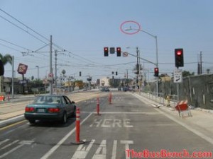
As workers finished exploratory drilling Thursday for the planned Westside subway extension, Los Angeles Mayor Antonio Villaraigosa and other elected officials said they want to speed up construction of the $4.1-billion transit project, which has been scheduled for completion in 2036.

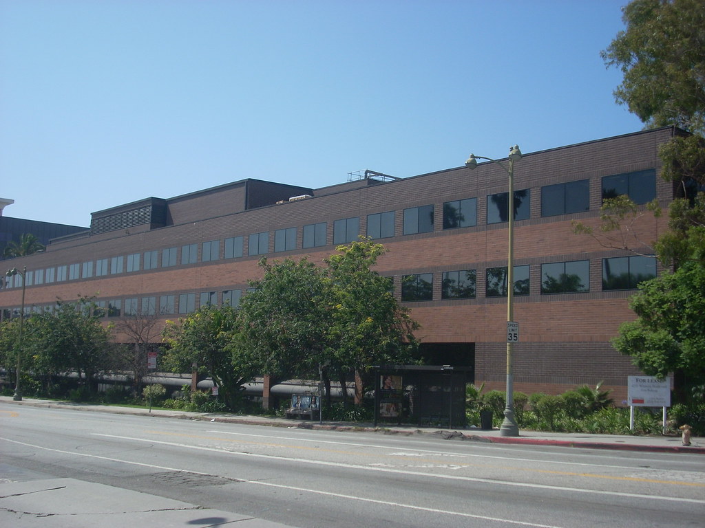
An outspoken advocate for the so-called Subway to the Sea, the mayor has long been frustrated by the project's timetable, and that was evident again when he and other officials gathered for a news conference in a UCLA parking lot. There, final soil samples had been drawn for a route that would follow Wilshire Boulevard from downtown Los Angeles to Westwood.

"I'm 56 now," said the mayor, who would be 83 if the extension were completed under the current schedule. "We are here today to make sure that it gets built before I'm 66."

Villaraigosa was joined by Los Angeles County Supervisor Zev Yaroslavsky, Los Angeles Councilmen Bill Rosendahl and Paul Koretz, Santa Monica Councilwoman Pam O'Connor and Glendale Councilman Ara Najarian, the chairman of the Los Angeles County Metropolitan Transportation Authority Board of Directors.

They urged local governments to put aside their differences over planned transportation projects and launch a coordinated effort to secure enough federal stimulus dollars and matching funds to expedite the subway extension as well as other much-anticipated projects to be financed by Measure R, the county's new transportation sales tax.

Those include the Expo Line light-rail route from downtown to Santa Monica with a completion date in 2015, the Gold Line's Foothill extension to perhaps Azusa by 2017 and a downtown light-rail line to connect the Blue, Gold and Expo lines by 2025.

"We need a unified approach to get federal money. We need to bring the MTA board together," Najarian said. "If it all comes together, we will be a force to be reckoned with. We will be able to advance all our projects."

Officials said the subway extension deserves to be given a priority because it would serve one of the most heavily populated areas of Los Angeles and help relieve traffic on some of the region's busiest streets and highways, such as Wilshire Boulevard and the 10 and 405 freeways. MTA officials predict that the subway will generate 75,000 to 116,000 boardings a day shortly after it opens.

Should the project receive adequate federal assistance, Villaraigosa predicted that the subway to the Westside could be finished in 10 years, or about 17 years ahead of the current timetable.

The MTA is considering several alignments that would extend the subway from the Wilshire-Western station to Westwood with additional routes into Santa Monica and West Hollywood.

The estimated cost of the line is $4.1 billion if built to Westwood, $6.1 billion if built to Santa Monica and $9 billion if the project includes routes to West Hollywood and Santa Monica. Selecting a preferred alignment is set for next year.

Part of the money for the subway will come from Measure R, which is expected to generate up to $40 billion during the next 30 years.

dan.weikel@latimes.com

Copyright © 2009, The Los Angeles Times


Villaraigosa Campaigns for Westside Subway’s Completion in Ten Years (Source: The transport politic)

the transport politic » Villaraigosa Campaigns for Westside Subway’s Completion in Ten Years
Villaraigosa Campaigns for Westside Subway’s Completion in Ten Years

August 21, 2009

Los Angels West Side Subway Alignment AlternativesProposed 2036 completion date — without extension to Santa Monica — worries the Los Angeles mayor.

Last November, Los Angeles County voters agreed to increase sales taxes by a 1/2¢ with the passage of Measure R, which will fund new transit projects throughout the region. One of the primary benefits of the new revenue is the ability to fund the construction of a “subway to the sea,” which will extend the existing Red and Purple heavy rail lines to Santa Monica. But the large number of projects on the drawing board have slowed down this west side corridor significantly; partial completion, along Wilshire from Western Ave to UCLA, won’t be done until 2036. But Mayor Antonio Villaraigosa is now on a campaign to attract federal funds to push its completion date forward — perhaps to 2020.

For the first time in more than a decade, the west side extension, which has often been included in the city’s transit plans, looks like it might happen. After years of controversy, a loss of federal funds, and gas explosions, the stars have aligned, with local and federal money available and an ambitious transit agency board again willing to risk its political clout for a project that will serve Los Angeles’ densest and most traffic-choked community.

Yet, even with Measure R, Los Angeles will need decades to build this very expensive line. Estimates put total cost in a $4-9 billion range, depending on whether the route extends all the way to Santa Monica, rather than simply to Westwood, and whether a spur north through West Hollywood is included. The full project, with 14 stations, will greatly improve connectivity across the west side of Los Angeles as well as among the cities of Beverly Hills and Santa Monica; this is currently the preferred choice of most residents of the area and Metro itself. The project, though, is too expensive to build without a massive federal appropriation.

Metro, the local transit agency, initiated the completion of a draft Environmental Impact Statement on the line in January, beginning the first step towards what will be a major construction project. Metro will select a locally preferred alternative next fall and then begin engineering and eventually construction work. In the meantime, the city has been drilling holes across the west side — 70 of them in total, up to 80 feet into the ground — to begin assessing the quality of soil for subway construction. The results were positive, with no danger in sight.

Mr. Villaraigosa, in the meantime, has become a strong advocate of regional cooperation for the benefit of the project. The mayor encouraged politicians from across the County to push for federal funds to complete the line on an accelerated timetable. The U.S. government needs to expedite up to $5 billion to ensure that the full project can be completed. This kind of commitment, however, has been rare in recent American transit policy, which has rarely appropriated more than $1 billion to just one line.

The mayor’s vision is necessary, because a wait until 2036 for just the line to UCLA would be a disappointment and a disaster for the city as a whole. The traffic mess on the west side, even with the completion of the Expo Line, will not improve dramatically; the area continues to be the region’s biggest draw but it is harder and harder to reach. With direct benefits only being accrued in four of the region’s dozens of municipalities, it remains to be seen whether mayors and congressmen from the sprawling region will come together in support of the project.

Image above: Westside subway alignment alternatives, from Metro


Separate but Equal Treatment via Rail Lines in L.A. (Source: LA Eastside)

LA Eastside » Separate but Equal Treatment via Rail Lines in L.A.
Separate but Equal Treatment via Rail Lines in L.A.

by Browne Molyneux

The Rail around Indiana

If you look at this photo you wonder what is this? And how did anyone think this was safe?

Why is the safety method on the Eastside going to be of the “pull yourselves up by the bootstraps” variety via cameras to blame personal drivers and old men in yellow vests reminding people to “be safe,” while the City of Los Angeles west of LaCienega get the “silver spoon” variety of safety with expensive barriers and elevated stations?

Why will there will be no testing out Darwinism theory of survival of the fittest on the Westside?

Only the neighborhoods with higher concentrations of poor people and brown and black people are tested with sink and swim theories.

The rail dips just one mile into the magic dividing line of LaCienega and the people on that side of LA who don’t walk or even use public transit as extensively as people on the Eastside get all of our tax dollars spent protecting them from being hit by a train that most of them won’t even take or even be near outside of driving by its protected barrier.

(This is an excerpt of a very long post entitled “Cameras Aren’t Going to Make Fewer People Die.”)

by Browne Molyneux


One step closer to subway: Electeds and high-level officials gather to celebrate soil sample collection in Westwood parking lot (Source: The LA Subway Blog)

The LA Subway Blog: One step closer to subway: Electeds and high-level officials gather to celebrate soil sample collection in Westwood parking lot
One step closer to subway: Electeds and high-level officials gather to celebrate soil sample collection in Westwood parking lot
Thursday, August 20, 2009


Metro's drilling for soil samples in Lot 36 by Wilshire and Veteran.
Could the subway be here as soon as 2019?

That's what I heard today at a press conference called the mayor's office this morning at Lot 36, which is by Wilshire and Veteran. The occasion? The commencement of drilling for soil samples in Westwood as part of the draft EIR process for the Westside Subway Extension. Metro has already collected over 70 soil samples from various points along the projected subway route(s). The Westwood soil sample collection might have been pegged as significant for a myriad of reasons (for one, I'd like to think it was BTR's rogue grassroots Measure R campaign, which highlighted Westwood and Wilshire...)

Anyway, I'm vaguely trained in hard news writing, so I attempted to write up some of the statements made by Mayor Villaraigosa, Supervisor Zev Yaroslavsky, and many other elected politicians and high-level officials, such as Metro CEO Art Leahy. They called out for the passage of the LRTP (looong delayed); highlighted benefits (expanded mobility, travel time reductions, and job creation); and declared that with federal matching funds, the Wilshire Subway Extension could make it to Westwood in 10 years - meaning 2019.

L to R: Rita Robinson, General Manager at LADOT; Pam O'Connor, Mayor Pro-Templore of Santa Monica and Metro board member; LA Mayor Antonio Villaraigosa; County Supervisor Zev Yaroslavsky (speaking); Metro construction worker; LA Councilman Bill Rosendahl (he's tall).
This assumes many things happen, including...
1) It is safe to tunnel along the projected route
2) The delayed Long Range Transportation Plan is passed by Metro.
3) There is traction in the creation of a National Infrastructure Bank
4) Maybe our subway will even get a direct financial allocation in the renewal of SAFETLU, the federal government's transportation bill, scheduled for September.

Los Angeles Mayor Antonio Villaragoisa, UCLA Chancellor Gene Block, 5th District Councilman Paul Koretz and other area elected politicians and high-level public officials came together today at UCLA’s parking lot 36, by Wilshire and Veteran, to celebrate a major milestone in the path to building the Westside Subway Extension: the start of drilling for soil testing in Westwood, a potential western terminus.


Villaraigosa touted the Westwood soil sample collection as an important step in bringing the subway to fruition, a project that is Villaraigosa said would generate jobs, cut travel times, and end Los Angeles’s vulnerability as the punch line late night jokes about congestion and rush hour traffic.

The Westwood soil sample collection is one of over 70 samples collected this summer by the Los Angeles Metropolitan Transportation Authority for analysis as part of the subway extension’s draft environmental impact report.

At the press conference, Villaraigosa once again thanked voters for passing Measure R, which he and Los Angeles County Supervisor Zev Yaroskavky interpreted as a mandate from voters to build a rapid transit system which would transport Angelenos around the Westside and across the County.

Villaraigosa stated that with federal matching, the subway extension to Westwood could be completed as soon as 2019. Los Angeles will not see a Westwood subway station before 2036 if the city and Metro does nothing. This led Villaraigosa to call for the Metro Board of Directors to approve the Long Range Transportation Plan, whose passage was postponed to September last month, which would then enable Metro and other subway supporters to lobby for federal matching dollars.

Besides generating at least 32,000 construction jobs, the subway extension would expand mobility for the transit dependent, particularly those coming from the central and eastern parts of the County to job rich areas on the Westside, Yaroslavsky said. “The days when the west county’s transit needs get ignored are over,” Yaroslavsky declared.

Students, staff, and the 10 million annual visitors to UCLA would also benefit from the opening of a subway station in Westwood. “UCLA is the 7th largest employer in Los Angeles,” said UCLA Chancellor Gene Block, “and a subway would eliminate thousands of vehicle commute miles annually.”


UCLA Chancellor Gene Block talked about how UCLA would benefit from the subway


Thursday, August 20, 2009

Squeaky Wheels (Source: California High Speed Rail Blog)

California High Speed Rail Blog: Squeaky Wheels
Wednesday, August 19, 2009
Squeaky Wheels

This blog has paid a lot of attention to the debate over high speed rail on the Peninsula here in 2009. So much so that I'm sure folks sometimes wonder whether this is actually the Peninsula HSR blog or whether Clem's is. (In case anyone was wondering - Clem's blog is still the best place for Peninsula HSR discussion by quite a distance.)

That is a function of two basic factors. The first is that I simply don't have as much time to do HSR research as I did in 2008. While I'd like to have had time to develop a new platform for the blog, do some original research, and generate more original discussions, that time simply hasn't existed for me. That's the story of work in 2009 - one is either overwhelmed with it or has none and is desperate to get it. So I remain dependent on other news sources to generate posts here at the blog, with occasional help from folks who send in tips and story ideas (and thanks to you who do that!).

And that leads into the second factor: what remains of the state's media has spent more time on the Peninsula HSR battle than on any other aspect of the project. And that's because squeaky wheels get the grease. Peninsula NIMBYs have worked their media contacts quite well, aided by the existence of several online news outlets in the Menlo Park and Palo Alto communities. Whereas the Innovation Place project struggles to get public attention, the folks filing absurdist lawsuits get plenty of coverage. (And am I the only one who has noticed how these people are working at cross-purposes? If you succeed in giving Union Pacific veto power over the corridor, then a tunnel will never happen.)

Some of this is due to the ingrown bias of the media in this state. Having become familiar with NIMBYism over the decades, they are willing to make it sound as if the only thing that is newsworthy about the HSR project is the folks on the Peninsula who are flipping out about it.

Don't get me wrong - those NIMBYs do have very real power. They represent, alongside State Senator Alan Lowenthal, one of the primary threats to the project's viability. They have the money, skills, and tactics needed to block the project.

But we should not mistake that as a sign of their relevance to the overall project, the mistake John Horgan made in yesterday's Mercury News in his assessment of Quentin Kopp's recent op-ed:

Local folks foresee high-speed rail and Caltrain combining to produce precisely that sort of devastating and grim scenario here, particularly in vital downtown areas, although Kopp and other HSR types have stated that four tracks, not six, would be used on the Peninsula. But even that remains to be seen...

Kopp concluded his essay in a conciliatory tone, noting that engineering and design solutions are "achievable and can be adopted here at home to preserve the character and healthy environment of our communities while supplying California with a sustainable transportation alternative to gridlock."

Let's hope he's right. There is no area of the Golden State with more at stake than this one.


It's that last line which I find so stunning. There are plenty of areas of California with more at stake than the Peninsula. The Transbay Terminal is a key element of downtown San Francisco's transportation plans. San Jose will experience significant new growth - of the desirable centrally located urban in-fill sort. Southern California will have a revolutionized transportation network that will help ease congestion and fuel the growth of more mass transit options.

But if you want to find a part of the state with more at stake than any other when it comes to high speed rail, you need to look not amidst the wealth of the Peninsula. You need to look in the Central Valley. Merced, Fresno, and Bakersfield will be utterly transformed by high speed rail. Cities that are struggling with some of the state's highest unemployment rates and some of the world's highest foreclosure rates will have the opportunity to enjoy major and sustained economic growth. HSR will take these cities, currently and unfairly seen as backwaters in a state focused on the two coastal megalopolises, and give them the chance to participate in the 21st century economy. Fresno and Bakersfield will be less than 2 hours away from downtown SF and downtown LA. That's a reasonable commute time, meaning workers in the SF and LA areas can afford to live in the Central Valley, where housing is currently quite affordable. That will in turn bring new jobs and other opportunities to those cities that at present lack other options.

Ultimately, of course, it is the state as a whole that has an enormous amount at stake with the HSR project. It is essential to our future economic security, our energy independence, our strategies to reduce pollution and address global warming, and to our efforts to seed and support urban infill density that we build the high speed rail project as laid out in the voter-approved Proposition 1A.

Squeaky wheels may get all the attention, but it should not lead us to ignore the rest of the train.
Posted by Robert Cruickshank at 8:04 AM


As Metro Tries to Grow Rail Service, Controversies Grow with Them (Source:Streetsblog Los Angeles)

Streetsblog Los Angeles » As Metro Tries to Grow Rail Service, Controversies Grow with Them
Wednesday, August 19, 2009 21 Comments
As Metro Tries to Grow Rail Service, Controversies Grow with Them

by Damien Newton on August 19, 2009

Metro via Blogdowntown
Three potential Metro rail projects have been in the news recently, and two of them are being dogged by controversy as another continues to cruise during its early phases.

The controversy that might be newest to long-time readers is the objections of Little Tokyo residents to the proposed Regional Connector. Residents are up in arms over the impact that the project will have on their community regardless of whether it is built at-grade or below-grade. The Local Blog, Little Tokyo Unblogged explains the opposition in a harshly worded editorial entitled Metro Regional Disconnect:

And here we are today, being asked to take yet another “one for the team,” so some hypothetical riders in the future can travel from Long Beach to Pasadena and not have to pay a transfer fare of $1.25 or have to transfer from one train to another--something millions of people do in public transit-oriented cities throughout the world every day. Or, as someone at the meeting pointed out, is Little Tokyo being asked to sacrifice in order to “fix” a gap in Metro’s original vision of “seamless travel “ that ineptitude or lack of foresight created?

One entire block and maybe 20-30 family-owned businesses, who are already hanging on by a fingernail thanks to the current economy. So people don’t have to transfer trains? Buy a transfer ticket? To fix something that shouldn’t have been broken in the first place?

A second concern over the impact of construction, which is estimated to take up to four years would have on their community regardless of whether the trains are built at-grade. Little Tokyo blogger Rafu Shimpo explains the concerns:

“It’s quite devastating what could happen over four years (of the construction),” said Akemi Kikumura Yano, CEO of the Japanese American National Museum, which hosted the event.

“Possible massive disruption, in terms of access, not only to the Japanese American National Museum, but to Little Tokyo in general, I think that is a major concern for us… How are we going to survive?” she said, during the Q&A portion of the meeting.

It sounds like an ugly fight is brewing with Metro and rail activists taking on the Little Tokyo community. Hopefully Metro can find a way to work with the community as the Connector is viewed by many as the most important part of Metro's expansion plans.

The other controversial rail project is Phase II of the Expo Line. Having survived attempts to derail the project in South L.A., so far; Expo now faces challenges to the second Phase of the project. However, this time the opposition isn't coming from Cheviot Hills, it's coming from Santa Monica.

Over the last two weeks, a series of articles and opinion pieces from Santa Monica based news papers shows that residents there are readyying for a fight over the location of the rail yard that would house the light rail trains when they aren't on the tracks. The two main arguments are that the yards will be bad for Santa Monica College, and that because of the yard's proximity to lower-income housing, that the yard's construction and operation are an environmental justice violation.

The last rail line that's been in the news is the Westside Subway, aka the Subway to the Sea. A series of informational meetings were held in August, and thus far the controversy over this project has been a funding one that is confined to funding squabbles at the Metro Board level. Streetsblog contributer Alexander Friedman was at the West Hollywood meeting and was thrilled that Metro seems to be embracing a design that would have the Subway run through West Hollywood and the Wilshire District.

It looks like not just the public, but - the MTA - are all in favor of the combined Wilshire with Santa Monica Blvd lines!

This is great news, as both corridors are promising as far as success and high ridership.

Jody Litvak also provided an in-depth report about Construction of subway, including length of times and - how specifically construction is done. This is encouraging, as - for the first time MTA staff was getting into the details of construction itself! - not just planning....
Practically every single person spoke in favor of the combined option (Alternative 11), i.e. construction of both Wilshire and Santa Monica Blvd lines. Indeed, it does make sense to construct the two, as - both lines will complement each other, drawing crowds from all over the city, and building both lines will provide an imcomparibly better connectivity throughout the city.

In short, August was a big month for three very different rail projects that are going in three different directions. How the projects move forward could very well depend on how Metro is able to work with the community.


Westside Subway Exploratory Drilling Completed, Villaraigosa Drops the Phrase 'Subway to the Sea' (Source: LAist)

Westside Subway Exploratory Drilling Completed, Villaraigosa Drops the Phrase 'Subway to the Sea' - LAist
Westside Subway Exploratory Drilling Completed, Villaraigosa Drops the Phrase 'Subway to the Sea'


Photo by honeybeejen via LAist Featured Photos

Over the past few months, Metro has been drilling for soil samples throughout the Westside so below ground conditions could be analyzed as plans for the subway route and construction can be made. The Metro Board still has not voted on whether or not to move forward with a subway, but this information is part of the environmental research that must be done before such a decision can be made. Over 70 locations were drilled.

Mayor Villaraigosa, who will speak at an event tomorrow about the drilling, has dropped his slogan, "subway to the sea," speaking in a couple press advisories today. “Every day, 40,000 to 80,000 cars travel along Wilshire Boulevard, coming from all corners of the county," he said in a statement. "From Long Beach, the San Gabriel Valley, the San Fernando Valley, people drive Wilshire to get to work. Bringing the subway to Westwood will help the entire county get here faster, with less pollution every day.”

Villaraigosa used the "Subway to the Sea" phrase in his state of the city address in April of this year. In fact, he's used it a lot in the past, even when Metro cautiously was using "Westside Extension" and was warning over a year ago that it may end at the 405. Even if current plans and funding expectations only allow for the subway to go so far, in this case U-Sea-L-A, it seems the dream to someday subway it over the sea has vanished, at least for now (or in today's press advisories). We hope he continues to fight the good fight to pave the way for that reality, although a bleak one when talking money.

Speaking in terms of the current economy, the cost of extending the Purple Line from Wilshire and Western to 405 Freeway in Westwood is estimated to be $4.1 billion. Add on a West Hollywood hook between Hollywood and Century City and the price tag goes up another $2 billion. Funding will come from Measure R and potentially federal sources and public-private partnerships.

A trip from Koreatown to UCLA is estimated to take 13 minutes. From North Hollywood, 42 minutes.
user-pic
By Zach Behrens in News on August 19, 2009 5:30 PM


Wednesday, August 19, 2009

Demystifying Legalese in Contracts, Part I

Demystifying Legalese in Contracts, Part I - BusinessWeek
Demystifying Legalese in Contracts, Part I

Posted by: Nick Leiber on August 17

This is a post by guest blogger Jonathan I. Ezor.

jonathan_ezor.jpgOne of the complaints frequently leveled against attorneys is that they speak, and write, a language foreign to all other people: legalese. This tongue, filled with words and phrases like “heretofore,” “hereinafter,” “notwithstanding the foregoing,” “including but not limited to” and “except as otherwise provided herein,” is most commonly seen in contracts, and seems to be best expressed in

very tiny letters.

The phenomenon causes most businesspeople, and even many other lawyers, to give up before ever trying to understand what the contract says.

This is extremely unfortunate and wrong, since a "contract" is also an "agreement," which means that the parties who are actually bound by it are supposed to agree to its terms, which really requires understanding them. The best contracts lawyers are actually good writers, able to turn a variety of business points into a single, comprehensible and consistent document. While there are some words that have specific legal meaning and need to be included in a contract ("warranty," for example, rather than simply "promise"), the rest of the language should be understandable to everyone involved. If the client can't read a contract and figure out what it means, it's a bad contract. Worse still, vague language will more likely lead to a lawsuit than do clear provisions, since misunderstanding is a frequent driver of disputes.

While all attorneys should strive to be better, clearer writers, there are other things that also can help make legalese more understandable to businesspeople. The next few articles in this blog series will be dedicated to demystifying typical contract provisions, using a Web development agreement (a frequent source of misunderstanding and conflict) as a model.

From warranties and representations to indemnification to the specifications to termination and beyond, the goal is to help turn the contracts readers get (and give) in business from gobbledegook into guideposts.

For starters, consider a provision often buried in the "Miscellaneous" (which many translate as "skim or even ignore this") section of a contract: the choice of law and forum clause. It usually looks like this:

This contract and any disputes hereunder shall be governed by the laws of the State of New York, excluding any principles of conflicts of laws. The exclusive forum for any disputes hereunder shall be the state and federal courts in the City of New York, State of New York.

There are two important pieces here. The first tells you which laws will be used to explain and interpret the contract, in this case New York's. The "excluding any principles of conflicts of laws" part avoids the logic puzzle caused by looking at New York law about what law applies to a contract: "New York law is supposed to apply, but New York law says that this contract should be governed by Texas law because the two parties are in Texas, but the contract says that New York law is supposed to apply, but..." Most states' laws are fairly similar, but you should still ask your lawyer if one or another has some unforeseen landmines (often regarding consumer or employee protection) that makes the choice troublesome.

The second piece, though, is almost purely strategic: where do disputes get heard? The short answer is often, "in the city where the more powerful party is located." Why? So that, if the parties are in different locations, the one with the power will find it much easier to bring a lawsuit than will the other. Consider if Fredco is in New York and Murrayco is in Los Angeles, and they sign a contract with the New York forum language. If Fredco cheats Murrayco, Murrayco will have to find a New York lawyer, travel to and stay in New York, and lose the services of any Murrayco employees in New York if it wants to sue Fredco. By contrast, Fredco's general counsel can hop on the nearest subway down to the courthouse and sue Fredco, forcing it to come East to defend itself. A New York forum is clearly better for Fredco than Murrayco.

What can Murrayco (or your company) do when faced with a far-away forum demanded by the other side to a deal? One productive approach is to propose the following alternative:

The exclusive forum for any disputes hereunder shall be the state and federal courts nearest the party against whom the dispute is brought.

In other words, if Fredco wants to sue Murrayco, it has to go to Los Angeles.

For Murrayco to sue Fredco, it must come to New York. Equal disincentives to sue, equal encouragement to settle, and it's very difficult for Fredco's lawyer to reasonably object to the suggestion.

The next blog will demystify one of the most important, and least clear, portions of most business contracts: the warranty provision. If you have suggestions for provisions you would like demystified, please feel free to e-mail your ideas.

Jonathan I. Ezor is the director of the Touro Law Center Institute for Business, Law and Technology, and an assistant professor of law and technology. He also serves as special counsel to The Lustigman Firm, a marketing and advertising law firm based in Manhattan. A technology attorney for more than 15 years, Ezor has represented advertising agencies, software developers, banks, retailers, and Internet service providers, and has been in-house counsel to an online retailer, an Internet-based document printing firm, and a multinational Web and software development company.


Metro Presents Regional Rail Connector to a Wary Little Tokyo Audience (Source: LAist)

Metro Presents Regional Rail Connector to a Wary Little Tokyo Audience - LAist
Metro Presents Regional Rail Connector to a Wary Little Tokyo Audience

Metro Conceptual 1st / Alameda Flyover from blogdowntown on Vimeo.


Here at 1st and Alameda in Little Tokyo, here's a Metro conceptual of how trains, vehicles and pedestrians will come together | Video via blogdowntown on Vimeo.

An option for Metro's Regional Connector in downtown won't be officially chosen until sometime next year (probably summer or fall), but Little Tokyo community members are severely concerned over one of the proposals that would bring some major changes to the neighborhood.

The regional connector would connect the Blue, Gold and Expo lines into a more seamless system. Trains would travel from Culver City to East LA and from Long Beach to Pasadena making Metro's rail system more efficient. Currently, the Blue Line and future Expo Line end at the 7th Metro Station and the Gold Line circumvents the eastside of downtown through Little Tokyo.

Two build ideas are on the table: underground and on the streets. In order for the less impactful-to-street-traffic underground option to work, it will have to transition to the Gold Line above ground in Little Tokyo, therefore changing the neighborhood's infrastructure. Last week's meeting with the Little Tokyo community proved Metro has a long way to go to win their support.

The construction period is of major concern, but also the long term effects of local traffic, the concept of a pedestrian flyover structure, access to local businesses and more. Question and answer periods reportedly "got very intense," according to Little Tokyo unBlogged.

By Zach Behrens in News on August 17, 2009 1:40 PM


Innovation Place (Source:California High Speed Rail Blog)

Link: California High Speed Rail Blog: Innovation Place
Innovation Place

Clem has a excellent overview of the tunnel and urban development concepts offered by a group calling itself Innovation Place. You can see some of their award-winning presentation or read more about the plan at Palo Alto Online. Clem's explanation of their ideas:

The crown jewel of Innovation Place is a complete transformation of the University Avenue station area, as envisioned in the team's graphic above. High speed rail or not, this area of Palo Alto is in dire need of a redesign; today, access between three important zones of activity (the University Avenue shopping district, Stanford University, and the Stanford Shopping Center) is a circuitous and dysfunctional jumble that is both unpleasant and time consuming to navigate, whether by foot, bike, car or bus. Neighboring areas just a few hundred feet apart feel miles away from each other.

The remainder of the Innovation Place proposal consists of a 31-acre linear park adjoining Alma Street, featuring a bike and pedestrian path and reuniting the two halves of Palo Alto formerly separated by the train tracks. The additional cost of putting the tracks underground would be financed by selling $700 million worth of air rights for development.


Go over to Clem's blog to read the full details and see some very intriguing designs, along with Clem's thoughts on the concept's strengths and weaknesses.

Personally I think this is exactly the kind of work that Palo Alto residents ought to be producing. Rather than trying to say "no" to the HSR/Caltrain project, the thinkers behind Innovation Place have said "yes" to integrating it into their community. It would be wonderful if Menlo Park and Atherton chose to follow this model instead of wasting taxpayer money on a lawsuit that is doomed to fail.

As to the concept (which should not be described as a "proposal" at this point since it isn't at that level of specificity), I like it. There's the question of the possible roller-coaster effect of a high speed train entering a tunnel for Palo Alto only, and whether $700 million is enough to underground the route. It's also unclear whether Union Pacific will go along with this, as it would pretty much eliminate their ability to continue freight operations over that section of track (although they could theoretically revive the Dumbarton corridor and use the shared tracks along the rest of the HSR/Caltrain corridor north to SF). But this is absolutely something worth exploring.
Posted by Robert Cruickshank at 10:29 PM


High-speed rail and Transit-Oriented Development: Right, from the start (Source: examiner.com)

Link: High-speed rail and Transit-Oriented Development: Right, from the start
Examiner Bio
High-speed rail and Transit-Oriented Development: Right, from the start

August 18, 12:20 PM
Fresno Green Transportation ExaminerAlan

High-speed rail is transportation that’s been elusive here and by this I mean it hasn’t materialized in America – not yet, but interest is certainly there and with vision, commitment, money, and tremendous government and public or user support, HSR will arrive! Where American HSR is going in is pretty much known. What remains to be determined is when it’ll be completed.

Assuming California gets high-speed rail up and running (and it should be a pretty good assumption at that), there's also the assumption that HSR stations will be TOD anchors (I’ll even go so far as to say “magnets”); i.e., for mixed-use, high-density Transit-Oriented Development.

According to Andrew Schweizer in the August 10, 2009 San Diego Business Journal article: “Rail Stops Envisioned as Starting Points for Development,” he refers to state HSR as “mass transit” and because it could be thought of as such, it seems only natural mixed-use, high-density station-connected or station-centered development would be in the offing once station construction is underway – or maybe even prior to.

“’I think not only is it something that is a good thing, it’s certainly going to be a phenomenal planning tool for the next generation of growth,’ said Perry Dealy, president of Dealy Development. ‘The opportunity to take the high-speed stop hubs and convert them to maximize their mixed-use, high-density potential is great. You’d have what I’d call a TOD, transit-oriented design, starting with residential, work-live, retail, entertainment and other kinds of venues that are part of the mixed-use characteristics,’” Schweizer wrote, quoting Dealy, of course.

I think Dealy is spot on.

Added Schweizer, “Construction most likely would start at the major stations in Los Angeles and Sacramento.” I believe the San Diego Business Journal staff writer, too, is on track.

What would have been surprising, on the other hand, is if Schweizer had named Bakersfield, Fresno, Merced or any other planned Valley HSR station location as venues to be among the firsts in state where TOD would commence. I say this with a relative high level of confidence, as the San Joaquin Valley is not somewhere one thinks of as TOD Meccas. Here’s hoping that all changes though.

So, too, here’s hoping California high-speed rail is well patronized when it gets built. Here’s also hoping a wave of mixed-use, high (or at least higher) density commercial and residential development commences at every planned station location, TOD just makes good sense – policy and business-wise. The proof is out there.


Addendum to “The Case for a Wilshire/Crenshaw Station” (Source: MetroRiderLA)

Addendum to “The Case for a Wilshire/Crenshaw Station” | MetroRiderLA
MetroRiderLA, Opinion, T.O.D.

Addendum to “The Case for a Wilshire/Crenshaw Station”
Contributed by Wad on August 19th, 2009 at 2:43 am

The discussion to the last thread, “The Case for a Wilshire/Crenshaw station”, was provocative enough to generate a lot of smart discussion. It also has generated quite a bit of attention, so welcome to those reading here for the first time or following from the following links:

* Metro’s Westside Subway Extension Facebook page
* LAist, which is generating its own discussions on this very same topic (with some identical comments seen here)
* The topic has some national interest from Reconnecting America (the Center for Transit-Oriented Development). It was the lead story in a subscriber e-newsletter. Thanks to Streetsblog’s Damien Newton for forwarding the e-newsletter.

If I missed any others, apologies for the omission. Feel free to post links in the comments.

Based on what I have found on the Census Bureau’s Web site, I will also do density profiles and transit usage data for other proposed stations. They won’t be cases for or against particular stations — Crenshaw was a unique case because Metro is keeping it as an option. The others are more definitive. I’ll get to them as I have the time, so I can’t promise any deadlines. Check back often.

I also want to give thanks to all the commenters, both supporters and opponents, for keeping the discussion civil and informative. Rapid Transit Advocate, in particular, has made some very persuasive comments against a station at Wilshire and Crenshaw boulevards.

I feel, though, some of his or her points need a strong counter-rebuttal.

In Comment No. 6, you allude to me negating my own argument by saying Crenshaw is close enough to Western to be redundant. The two stations would be a half-mile apart. That would be acceptable for an urban heavy rail system designed not only to be fast, but also carry hundreds of thousands — if not millions — of passengers daily. The subway is designed for capacity as much as for speed.

The subway has several station pairs that are less than a mile: Civic Center-Pershing Square; Pershing Square-7th Street Metro Center; Wilshire/Vermont-Wilshire-Normandie; Wilshire/Normandie-Wilshire/Western; and Hollywood/Vine-Hollywood/Highland. It’s not without precedent. Also, a station generates more riders when it exists than when it doesn’t.

That’s a “Well, duh!” thing to say, but it’s a way of illustrating the network effect. The choice comes down to build or no build, but the consequences on ridership have broader consequences. What choice will produce more ridership: One station or one minute of time saved?

A trip from Western to Crenshaw would be one minute, based on the same time and distance between the Western and Normandie stations. The distance from Crenshaw to La Brea is 1.5 miles, which is close to 2 minutes based on current schedules. Western to La Brea is 2 miles. Because of the great distance between those stops, a train can likely go between the two stops in 2 to 3 minutes.

The time penalty of a Crenshaw stop would be 1 minute at most.

How much ridership do you suppose the subway loses on account of the one minute penalty? And conversely, how many more people would be making subway trips because it was one minute faster?

Weigh that number versus the addition of a station at Wilshire/Crenshaw. Will there be more riders using a station at Crenshaw versus the ridership lost because of the one minute penalty? Or can we skip the Crenshaw station knowing that the lost ridership is offset by those who gained a minute faster ride?

The network effect of a Crenshaw station influences the activity of at least one other station on the subway. One boarding gained at Wilshire/Crenshaw is one exit gained somewhere else. Also, Wilshire/Crenshaw is a “center” station, as the strip of office buildings within walking distance of the station means it is a destination for workers just as much as it is for Park Mile-area residents heading to jobs elsewhere. It is also a destination for schools, churches and a performing arts space.

The residences can be seen in the Census maps. I framed those around the proposed station’s likely catch area, bounded by Wilton to the east, Olympic to the South, Lucerne and Rossmore to the west and 3rd to the north. I used Wilton as a cutoff because it is exactly halfway between Crenshaw and Western, so there’s a quarter-mile bias rather than a half-mile bias. The census tract view in each of the 3 zip codes gives a snapshot of population per square mile. Most of the tracts are in the palest shade. In 90005, however, the palest shade lumps together the lowest density of 4,233 p/mi^2 and 12,342 p/mi^2. The lowest density, 4,233 p/mi^2, is the tony northwest section between Irving, 6th, Rossmore and 3rd. Even this area is nearly twice as high as the Los Angeles County density of 2,344 p/mi^2.

The station site would be in tract 2127, which is the upper bound of 12,342 p/mi^2. This tract is more than 5 times the county density.

The next shade up is for an area between Wilshire, Wilton, 8th and Bronson. The census tract, 2126.10, shows the maximum bound for that shade: 30,029 p/mi^2. Just south of that is a pea-green shade for tract 2126.20, which is the maximum bound of 45,682 p/mi^2.

If you read the 90010 and 90020 data, you’ll also see a surprisingly dense pocket in the northwest quadrant of the station’s catch area, bounded by Wilton, Wilshire, Irving and 3rd. It falls under tract 2117.01, showing 11,792 p/mi^2.

What makes the neighborhoods around this station a case study is how the neighborhood camouflages its density. It’s overwhelmingly residential, but it’s how historical structures and land uses absorbed larger populations that weren’t supposed to appear but did anyway. It occurred because of the unique patchwork of buildings and land uses within this area created by osmosis.

So what’s my angle? I’m not supporting the Wilshire/Crenshaw station as a stalking horse to alter the neighborhood’s character or as a “Johnny Density-seed.” I don’t see a station as going hand-in-hand with the elimination of the HPOZs or even the Park Mile plan, for that matter. I support the station mainly to get transit right. Getting it right means not tunneling past an opportunity for the sake of political expediency or cutting corners to hit the federal subsidy sweet spot — then having to answer for it a generation later. What’s as bad as passing by Crenshaw? When the subway is built, the neighborhood gets a case of buyer’s remorse and demands an infill station at higher cost and disruption to a busy line.

The reason why Metro placed Crenshaw in the optional category is that the station is in limbo between two precedents: The subway battles of the 1970s-1980s in the very same neighborhood; and the Cheviot Hills right-of-way vs. Venice/Sepulveda diversion of more recent times. It’s planning for both scenarios. It’s anticipating a fierce battle from the same neighborhood groups as before, and it must decide if it should acquiesce or engage opposition. It also must give equal weight to each alternative.

It’s 30 years later, and it’s the same neighborhood but a very different L.A. The neighborhoods in question are not only heavily dense, but demographics have changed. Asians are the largest ethnic group in the three zip codes, and there are also many more Hispanics and mixed-race residents who have moved in. Not only that, but the areas already support a high degree of transit usage and walking for an area with no rail transit. The station is bringing together a neighborhood and a service that are compatible.


MTA Adding Turnstiles to Subway Stations (Source: KTLA)

MTA Adding Turnstiles to Subway Stations - KTLA
MTA Adding Turnstiles to Subway Stations

KTLA News

August 17, 2009


MTA Hopes to Increase Revenue with Turnstiles MTA Hopes to Increase Revenue with Turnstiles Video

LOS ANGELES -- Free rides will soon be over for some subway passengers in Los Angeles. The county Metropolitan Transportation Authority is taking steps to add turnstiles to several stations in an effort to save money, and improve safety.

The MTA is trying to erase its reputation as the only major transit agency in the United States that doesn't equip its stations with turnstiles and security barriers.

For decades, the MTA has used a gate-free honor system in which passengers walk directly to train platforms without verifying that they have a ticket.

The only method used to catch fare cheaters is through random checks by civilian inspectors and sheriff's deputies. Those who are caught face a fine of up to $250.

Cheaters cost the system much more per year in lost revenue -- at least $5 million.

Eight turnstiles are currently in use on a trial basis at the Alameda Street portal for the Red Line stop in Union Station, and five are operating at the Wilshire-Normandie station.

By the end of August, 12 turnstiles are expected to be installed at the Pershing Square station and 10 at Westlake-MacArthur Park.

If the gates prove effective, the MTA will proceed with a $46-million plan to install 387 turnstiles and security fences by early 2010 at all subway and Green Line light-rail stations and at selected stops for the Blue Line and Gold Line light-rail trains.

Copyright © 2009, KTLA-TV, Los Angeles


Regional Connector Debate Hits Little Tokyo (Source: blogdowntown.com)

Link: Regional Connector Debate Hits Little Tokyo :: blogdowntown
Regional Connector Debate Hits Little Tokyo
By Eric Richardson
Published: Friday, August 14, 2009, at 11:13AM

Conceptual Design for 1st & Alameda Metro

Still looking eastbound on 1st street from a video showing a proposed conceptual design for 1st and Alameda, the intersection where trains, traffic and pedestrians would intersect.

DOWNTOWN LOS ANGELES — Metro's Regional Connector project has gained significant traction since scoping meetings kicked off in late 2007, but the planning process seems to have run into its first serious community opposition in Little Tokyo.

The project will connect the transit operator's light rail lines by building a link between the Blue Line at 7th / Metro and the Gold Line's Little Tokyo / Arts District station. At a meeting last week, vocal community members expressed their desire for that link to steer clear of their neighborhood.

Metro is currently considering two major options for the line, one that runs primarily above-ground and one that is primarily underground. The surface route would veer north by City Hall, connecting to the Gold Line at Temple street.

The underground option would travel under 2nd street, surfacing on the block that houses Office Depot before crossing the intersection of 1st and Alameda at grade.

Concerns in Little Tokyo focus on construction impacts and the way in which easier accessibility might change the character of the historic neighborhood.

Little Tokyo UnBlogged and Rafu Shimpo provide coverage that includes quotes and opinions from community members at the meeting.
Rafu Shimpo: J-Town Airs Regional Connector Concerns

“It’s quite devastating what could happen over four years (of the construction),” said Akemi Kikumura Yano, CEO of the Japanese American National Museum, which hosted the event.

“Possible massive disruption, in terms of access, not only to the Japanese American National Museum, but to Little Tokyo in general, I think that is a major concern for us… How are we going to survive?” she said, during the Q&A portion of the meeting.

Little Tokyo UnBlogged: Metro Regional DisConnect

And here we are today, being asked to take yet another “one for the team,” so some hypothetical riders in the future can travel from Long Beach to Pasadena and not have to pay a transfer fare of $1.25 or have to transfer from one train to another--something millions of people do in public transit-oriented cities throughout the world every day. Or, as someone at the meeting pointed out, is Little Tokyo being asked to sacrifice in order to “fix” a gap in Metro’s original vision of “seamless travel “ that ineptitude or lack of foresight created?

Little Tokyo UnBlogged: MTA Regional Connector Meeting (8/5)

After the presentation the floor was opened up to for the community to raise their voice for questions, comments and concerns. This part of the meeting got very intense, many community members raised tough questions and serious concerns, about the impact of a regional connector on Little Tokyo. Metro staff took notes and recorded the feedback from the community.

At the meeting, Metro also unveiled a 3D rendering of the way it proposes to handle the intersection of traffic, trains and pedestrians at 1st and Alameda should the underground option be chosen.


Metro Conceptual 1st / Alameda Flyover from blogdowntown on Vimeo.


Introducing the Golden Gate Mariner (Source: California High Speed Rail Blog)

Link: California High Speed Rail Blog: Introducing the Golden Gate Mariner
Saturday, August 15, 2009
Introducing the Golden Gate Mariner

by Rafael

This post is about an ambitious idea I had for a new regional light rail/streetcar line between downtown San Francisco and San Rafael in Marin County. While the primary purpose would be local and regional transit for residents of Marin county, it would also connect both them and Sonoma county residents (via connection to SMART) to high speed rail at the future Transbay Terminal Center.

A Brief History of Transit between SF and Marin County

Early in the 20th century, the only way to cross the Golden Gate Strait was with a ferry from piers along the SF Embarcadero to either Sausalito or Tiburon. From there, a standard and a separate narrow gauge railroad provided connecting passenger service to points north.

When the Golden Gate suspension bridge was designed to accelerate transit, the plan was to support streetcar service on two of its lanes. However, the actual construction never featured any rails because there was never anything to connect them to at either end. By the late thirties, transit agencies were switching to diesel buses which were more flexible and cheaper to operate. That is still the case today, but bus ridership suffered greatly once just about everyone could afford cars of his or her own. For a variety of reasons, electric trains - especially grade-separated subways - tend to be more popular with commuters.

The principal problems the popularity of private cars created for urban planners are road congestion and land use for parking spaces. Congestion also impedes bus and streetcar operations. Air quality issues related to gasoline cars have receded thanks to three-way catalysts. Comparable technology for diesel engines is much more expensive and was not even available in California before late 2008.

In a rare example of prescient regional transportation planning, an Army-Navy board convened after WW2 recommended the construction of a fully grade separated electric rail network spanning San Francisco, San Mateo, Marin, Alameda and Costra Contra counties. Since only the lower deck of the western span of the Bay Bridge had been constructed to support trolley service from the East Bay to the SF Transbay Terminal, the whole bridge was to be given over to motor vehicles. The new trains would run out to Daly City in a subway under Market Street, with a fancy new transbay tube across the Bay. Soon after, this plan became the basis for the civilian BART organization.

San Mateo soon bowed out, citing the high cost of full grade separation required to enable third rail operations. In addition, Standard Pacific already provided diesel-based passenger rail service into San Francisco. Keep in mind that at time, this was profitable, the peninsula was sparsely populated and no-one had even conceived of Silicon Valley.

BART engineers had picked 1676mm broad gauge for the new network, in part to provide mor stability for the planned Marin line across the Golden Gate bridge. Marin county withdrew from BART regardless. The primary reason was its limited tax base, but there was also some renewed discussion of whether the Golden Gate bridge could support the BART trains, which are longer than streetcars (though lighter per unit length, which matters more for bridge safety). Up to a point, the engineering discussion may have been a bureaucratic smoke screen: the Golden Gate Transit Authority was jealously guarding its turf, which included the bridge and toll collection on it.

Right of Way Preservation Efforts

Marin county did spend quite a bit of time and money on studies related to the old railroad lines, whose fortunes had declined due to competition from US 101, increasing opposition to logging in old-growth temperate rainforests, tunnel fires and the high cost of maintaining the Eel River valley line up to Eureka. Certain sections are prone to flooding and/or geologically unstable.

The county and its neighbor to the north, Sonoma, ended up purchasing the right of way between Corte Madera and Ignacio, just south of Novato Junction. Between Corte Madera and Sausalito, the old right of way is being preserved as a bike route called the North-South Greenway. Bicycles are serious business in Marin: millions are currently being spent on restoring the old railroad tunnels, something cyclists in Santa Cruz county can only dream of. Parts of the old line between Corte Madera and Tiburon are also being preserved as bike trails today.

The section between Schellville Junction (south of Sonoma town), Novato Junction and Eureka was taken over by the North Coast Rail Authority (NCRA), a California state agency created specifically to keep the ROW from being abandoned. In 2006, it leased the right to operate to the resurrected Northwestern Pacific Railway (NWP). It intends to minimally rehabilitate the line - top speed 10mph in some sections - to support the extraction of aggregate from the Eel River valley. Tracks still exist between Schellville Junction and Fairfield Junction with the Capitol Corridor main line, though they will also need to be rehabilitated before they can be brought back into service.

Coming full circle

In retrospect, many North Bay residents now regret Marin's 1961 decision to withdraw from BART. The Golden Gate bridge is now badly congested during rush hour, tolls have since risen to $6 southbound and all-day parking in SF has also become very expensive.

In 2008, a 2/3 majority of combined Marin and Sonoma county voters approved a sales tax hike to fund the resumption of passenger rail service between Cloverdale and the Larkspur ferry terminal under the name SMART (Sonoma-Marin Train). To preserve the option of double-tracking at some point in the future, a bike trail will run next to the restored line. Detractors rightly point out that that any future service to Sacramento and Oakland is just a pious hope at this point. For the moment at least, Marin county in particular is heavily dependent on its tenuous connections to San Francisco and Berkeley.

There is also concern that NWP's plan to support controversial mining operations in Mendocino county will lead to numerous heavy freight trains running through multiple Sonoma county towns at night, just to avoid conflicts with SMART's timetable during the day. NWP has already begun with rehabilitation work, so SMART may be forced to select FRA-compliant equipment such as DMUs from Colorado Railcar, which had briefly gone out of business in 2008.

Choosing FRA-compliant equipment would essentially kill whatever hint of a sliver of a chance there remains of ever laying heavy rail tracks south to Marin City, never mind Sausalito. Tracks across the Golden Gate and into downtown San Francisco seem even more outlandish.

Streetcar vs. Car, Sweet Car

Still, it's worth re-iterating that the Golden Gate bridge is badly congested, a situation that is unlikely to improve by itself anytime soon, if ever. FasTrak toll collection has certainly helped speed things along, but there are still plenty of people who prefer to pay cash. Restricting two lanes on 101 between San Rafael and the Marina district in SF to HOV vehicles would obviously increase throughput capacity, but it would also make commuting even more hellish for anyone who cannot - or will not - carpool. Private livery service is expensive and public buses not terribly popular.

One possible approach would be to forget about the Larkspur Ferry and terminate SMART in San Rafael instead. There, passengers would make a cross-platform transfer to a new light rail service which I've dubbed the "Golden Gate Mariner".


View Golden Gate Mariner (light rail) in a larger map

Provided cyclists agree to share the ROW as they already have for SMART, light rail should be compatible with current land use patterns in southern Marin county. The one significant caveat is that the old level railroad bridge across the Larkspur slough should be replaced. For a transit service that will run multiple times per hour, any swing or bascule section represents a risk to the timetable. The replacement should provide as much clearance as the adjacent freeway bridge. Fortunately, suitable light rail vehicles can handle grades as steep as 6%.

Service through Sausalito would be in streetcar mode. South of that point, there are two options:

OPTION #1 is to climb up to the Golden Gate bridge, run across that into the Presidio and head for the Marina District via Chrissy Field. Beyond that, trains could continue past Fort Mason to join up with the F-Market streetcar tracks along the Embarcadero, possibly hooking a left at 1st & Market to reach the new Transbay Terminal Center and looping back via Fremont Street.

The big plus of this option is that it avoids seriously breaking the bank by leveraging the existing Golden Gate bridge. It would not be necessary to dedicate lanes to streetcar service, only to ensure sufficient space in front of and behind the heavy light rail vehicle to avoid collisions and exceeding local load limits. In practical terms, that would not be easy to do. Railroads use block signaling, perhaps something comparable (but with very short blocks) could be used in this context. The streetcar lane could be monitored with video cameras, anyone running a red light would be fined.

This highlights the primary downside: sharing the existing bridge without dedicating one or two lanes to trains means inconveniencing motorists, even a potential safety hazard. Theoretically, light rail service would take more than enough cars off the bridge to compensate for the inconvenience. In practice, however, vehicle traffic volume tends to rebound before long as the population grows.

The other downside is that light rail is limited to low speeds in streetcar mode. The total distance for option #1 is only 20.8 miles, but it could take an hour to cover that distance.

OPTION #2 avoids the Golden Gate bridge, relying instead on a brand-new, dead straight tunnel under the Golden Gate between downtown Sausalito and Columbus Ave in SF. At 5.5mi, this isn't the shortest option for a bay crossing, but it does run along a ridge on the sea floor, this limiting how deep the tunnel would need to run.

The line would continue up Columbus Street in SF and joining up with the northern end of the Central Subway. Sharing track with that would require schedule integration, as SF Muni currently plans to run the Central Subway at 5 minute intervals during rush hour. If sharing is possible, the GG Mariner would connect to BART / SF Muni at Powell Street and to Caltrain at 4th & King/Townsend.

It would be possible to terminate the line at 3rd & Channel in Mission Bay. However, it would be useful to offer direct service to the TTC. Given that the complex vertical alignment of the Central Subway (option 3B per FTA's ROD), the only way to achieve that is with some new streetcar tracks to double back. The earliest opportunity would be Bryant Street just south of the portal, but it's a one-way street. It might make more sense to use SF Muni's existing tracks along King and Embarcadero, run past the ballpark and up 2nd (above the DTX tunnel). The line would end in a single-track loop via Natoma, 1st and Howard.

Still, single biggest advantage of option #2 would be the shorter distance and much straighter alignment into downtown SF and out to 4th & King. Line haul time from San Rafael could probably be reduced from an hour to less than 40 minutes. That would be a game changer in terms of modal market share among commuters. Compared to that, the awkward detour to get to the TTC is a small price to pay. In addition, option #2 would create a second fixed link across the GG strait, a very useful thing to have in case the Bridge or US-101 ever became unavailable for an extended period of time, e.g. after an earthquake.

The biggest downside, obviously, would be the fairly stupendous cost of constructing a bored tunnel under the Bay. The distance is much shorter than the one between England and France, but the ridership potential is also much smaller. There just aren't that many people in Marin county (or even Marin + Sonoma counties). A submerged floating tunnel, anyhow just a theoretical concept, is probably out of the question due to the high tidal currents in the Golden Gate.

Perhaps a conventional immersed tube might be viable, as long as it is buried deep enough to avoid undesirable interactions with the currents.

Rolling Stock and Yard

Since both options require a certain amount of streetcar service and would share some track and stations with SF Muni lines, the trains cannot be too long.

Regional light rail lines of similar length with sections of mixed traffic with local streetcars operate successfully in Europe, e.g. the WLB between Baden and Vienna, Austria. Their dual track line is 30.4km (19mi) long with a total of 34 stops, roughly comparable to option #1 above. WLB has run on overhead catenaries for over a century and serves 30,000 passengers a day at intervals of 7.5-30 minutes (varies by day, time of day and location). That corresponds to a modal share of ~40% of commuters, even though there is no single traffic choke point comparable to the Golden Gate bridge. Ticketing is integrated with the zone system used by the regional transit authority VOR.

WLB's new type 400 rolling stock is a custom low floor variant of Bombardier's Flexity Swift light rail product line. Each car is 27m long, doubly articulated, weighs 49 metric tonnes fully loaded and offers around 70 seats plus room for well over 100 standees. Typical trains feature 2 cars back-to-back, with the driver cabs at the free ends. For reference, WLB also operates some light freight trains on its own heavy rail tracks south of Schedifkaplatz and those of other railways.

Note that overhead catenaries and conductor rails (for low tunnels) are expensive but don't require full grade separation. For option #2, OCS is the only way to go. Option #1 could be theoretically implemented with a clean diesel powertrain as well, since the only tunnel is the short one in Mill Valley. Also, any proposal to add sturdy OCS poles and wire to the iconic GG bridge might well run into environmental objections.

Since most of the morning ridership on the GG Mariner would be southbound, it might be acceptable to make do with a single yard for overnight parking. The easiest location for that would be at the end of a short spur in Corte Madera, see map above. The location used to be part of the NWP line to Tiburon. The last trains of the day would dead-head there from San Rafael.
Posted by Rafael at 6:00 AM


Quentin Kopp Defends Pacheco Choice (Source: California High Speed Rail Blog)

California High Speed Rail Blog: Quentin Kopp Defends Pacheco Choice
Friday, August 14, 2009

Quentin Kopp Defends Pacheco Choice

Responding to a column in the San Mateo County Times by John Horgan, Quentin Kopp, member of the CHSRA Board and its president until last month, defends the choice of the Pacheco Pass alignment. Interesting reading, to be sure. After criticizing Horgan and the Times for publishing a "misleading" column and briefly describing the 10 years of studies that went into the alignment choice, Kopp offers this explanation for the choice:

The California High Speed Rail Authority has spent more than a decade studying the Peninsula Corridor and Altamont Pass or Pacheco Pass, and concluded twice that the Caltrain corridor is the premier solution for high-speed rail in California. The alternative route, over Altamont Pass, would bypass San Jose and San Francisco entirely.


That last sentence has been getting some attention in the comments to yesterday's post, with Morris Brown implying that Kopp is himself being misleading here, and potentially even violating CHSRA board policy in the process. Rafael agreed that the notion an Altamont alignment would cut off San Francisco and San Jose was "patent nonsense" but suggested that Kopp may have been thinking of one possible Altamont routing that would have sent trains to Oakland.

And yet Kopp is not wrong in the overall point, which is that Altamont had serious problems that could have produced significantly degraded service to SF and SJ. The concept being floated by some latter-day Altamont advocates is that San Jose would essentially be a stub track off the Dumbarton/Altamont mainline. San Jose wouldn't be cut off in this case, but it would get many fewer trains, as express SF-LA trains would not pass through Diridon Station at all. Rafael also pointed out in the comments that the Dumbarton corridor was far from an easy slam-dunk, presenting significant land use and engineering challenges. It is possible that those challenges may have ultimately forced an Oakland terminus.

AB 3034, which was approved by voters as Proposition 1A, mandated a 2 hour 40 minute runtime between SF and LA. As Pacheco is more direct and several miles shorter than the Altamont route, Pacheco met the standard. The same is true of the statutory requirement that SF Transbay Terminal be the route's northern terminus. AB 3034 wasn't yet law when the choice was made in July 2008, owing largely to Governor Arnold Schwarzenegger's delaying tactics on the state budget, but the key points of AB 3034 were already clear, and the existing Prop 1 already had much of that in place. So the CHSRA was constrained in its choices, and given those constraints, Pacheco is a legitimate solution.

Kopp offered further justification for the Pacheco choice:

A watchful public should be informed that this corridor has received more study than any other routes in California. If detractors want to cloud public memory, let me try to refresh it. Consider just a few of the reasons for choosing Pacheco Pass. An Altamont Pass alignment would require:

• Construction of a new transbay tube or bridge, an insanely costly endeavor, a threat to the Bay and certain to encounter opposition from environmentalists. Transformation of an antiquated 19th century railroad trestle bridge through a national wildlife refuge is a fantasy.

• As many as six tracks through developed East Bay communities, forcing expensive, controversial eminent domain proceedings and construction of elevated tracks, both bitterly opposed by residents and civic leaders.

• The splitting of trains, some going to San Jose and others northeast to San Francisco, eventually limiting the system's capacity and defeating the purpose of building high-speed rail service for Californians.


I discussed the first and third points above, but the second one is really worth noting. The Peninsula supporters of Altamont are being stunningly hypocritical in their demands - what they want to do is dump tracks they don't want onto neighborhoods across the bay. They are perfectly happy to force Pleasanton and Fremont to accept something they claim will kill communities.

Kopp also did a good job undermining the arguments made by the environmental groups that are party to the Altamont lawsuit:

You don't even need to accept my word. Consider that on April 30, 2008, the U.S. Environmental Protection Agency notified the Federal Railroad Administration and all interested persons that the corridor most likely to contain the least environmentally damaging practicable alternative for the Bay Area to Central Valley section is Pacheco Pass.

On May 8, 2008, the Army Corps of Engineers concurred, concluding the Pacheco Pass will cause less adverse effect to the aquatic ecosystem or other significant adverse environmental consequences, and "there are no other practical alternatives to the Pacheco Pass."


Some may argue that Pacheco has some environmental impacts, which it may. But the arguments being made here by federal regulators is that Pacheco's impacts are less than those of Altamont, particularly the Don Edwards National Wildlife Refuge.

Kopp closes his op-ed by calling for a "more reasoned discussion" of the matter. This reminds me of some of the health care town halls, where opponents of reform who know they have absolutely no chance to stop this through the usual political process (because the majority of Americans want reform to happen) have taken to trying to shout down their opponents. Although we haven't seen some of the more violent expressions of disagreement over HSR, I think there is a fundamental similarity between the health care disruptors and the folks behind this lawsuit. They didn't get their way in the normal process, and now they are trying to disrupt the HSR project rather than let it proceed, even though voters approved the project and the route.

There are productive ways Peninsula residents can help ensure HSR is built in a way that meets their needs. But this Altamont obsession is distracting them from that more necessary work. The sooner the Peninsula accepts the reality and permanence of the Pacheco alignment, the better they will be.
Posted by Robert Cruickshank at 10:43 AM


Monday, August 17, 2009

The case for a Wilshire/Crenshaw station (Source: MetroRiderLA)

The case for a Wilshire/Crenshaw station | MetroRiderLA
The case for a Wilshire/Crenshaw station
Contributed by Wad on August 17th, 2009 at 3:30 am

All photos are by Yours Truly. They can be seen on the MetroRiderLA Flickr pool.

Harbor Building, Wilshire Boulevard and Crenshaw Boulevard

The Harbor Building is one of the landmarks that can be seen from a future subway station at Wilshire and Crenshaw boulevards.

Metro, understandably, is seeing more and more support for a Wilshire Boulevard subway throughout the line between its current terminus in Koreatown to the Westside — as well as a swell of unexpected support for an extension in West Hollywood.

During the last series of scoping meetings, Metro representatives said the board will likely vote on a preliminary line by Fall 2010. This gives the neighborhoods a year to formalize where they want stations and what construction methods should be used to complete the project.

One of the stations along the line is still kept as optional: Wilshire Boulevard and Crenshaw Boulevard. At first appearance, it might seem understandable why this intersection may be poorly suited for a subway station. The first is a sentiment of fierce opposition from the three neighborhoods that the station would serve: Park Mile, Windsor Square and Windsor Village. Second is what is seemingly poor prospects for ridership: a T-intersection where Crenshaw ends, “very low” density, zero retail activity and very limited commercial zoning. Third is zero potential for development of any kind, as the neighborhoods are protected by historic protection overlay zones and specific plans that mandate free parking.

They are challenges, but certainly not insurmountable. In the broad view, though, a station at Crenshaw Boulevard will play a vital role when the Purple Line is fully built. Conversely, the absence of a Crenshaw station will be noticeable, frustrating, and will close the window on a chance for the neighborhood to become a part of the subway. The neighborhood can rise up now and force Metro to remove the subway station, but there’s the very real possibility that in a few years, current residents will reverse themselves or the neighborhood profile changes and residents would be more favorable to a subway station. It happened before … namely along everywhere else on Wilshire.

I think that a Wilshire/Crenshaw station would be appropriate, it would stimulate a respectable level of ridership, and still be respectful of the historic character of the neighborhood.

More than meets the eye

Los Altos Apartments Courtyard of Los Altos Apartments

Los Altos Apartments had seen its share of luxury in the early 20th century but went to seed during the last half. Now it is back again to recapture its splendor. The photo on the right is the courtyard seen from Wilshire Boulevard.

The neighborhoods around Wilshire/Crenshaw are multilayered — in more ways than one. The historic preservation zones attempts to impose a density limit and preserve the oldest and more palatial properties. However, the neighborhoods are hardly by the book. Mid-century development allowed a significant amount of density to trickle in. Some of the larger homes were divided up into duplexes, triplexes and quadriplexes, and a lot of homes during that time were knocked down for smaller apartment buildings and condos of 5-15 units. These are all mixed in the residential areas south of Wilshire.

Crenshaw Boulevard is an exception. Crenshaw is virtually all multiunit apartment buildings and condos of 2-4 stories between Wilshire and Olympic boulevards. It also has the connecting bus service of lines 210 and 710, which both connect with the subway in Hollywood or Koreatown, respectively.

As for the rest of the neighborhood, take a virtual walking tour of the neighborhoods surrounding the future station via Google Maps. Oddly enough, Crenshaw Boulevard is the only street the Google car has not motion-captured, but the apartments can be seen from the bird’s-eye view. But move the little man around and you’ll see splendid old homes, multiunits from converted homes and apartment buildings often all neighbors.

Does the neighborhood seem like it’s not dense enough to support heavy rail? Admittedly, this would apply for Windsor Square north of Wilshire. Yet most of the ridership is bound to come from south of Wilshire, with a chance of ridership coming from a dense pocket near the northeast as well. The likely ridership would come from an area bounded by Wilton Place to the east and Lucerne Boulevard and Rossmore Avenue to the west. There’s a gated community, Fremont Place, just west of Lucerne.

Perino's Apartments Perino's Apartments facing Wilshire Blvd.

Perino’s had once been one of L.A.’s most exclusive restaurants, but when it closed, the land sat empty for nearly 20 years until it had been redeveloped into these apartments. The front entrance on Norton incorporates the logo and the awning that used to be on the old restaurant. This apartment tests the restrictions of the Park Mile Specific Plan.

So what do the numbers say? Let’s consult the data from the Census Bureau. The maps use data that will be outdated by next year, but surely the 2010 Census will reveal that the neighborhood has become more populated. The snapshot is the census tracts near Wilshire and Crenshaw, with Wilton Place as the eastern boundary and Olympic Boulevard as the southern boundary. Wilton Place is about equidistant from Crenshaw and Western Avenue, and implicitly, residents east of Wilton are more likely to use the existing Wilshire/Western station.

Condo buildings at Wilshire Blvd. & Norton Av. Condos as seen from Wilshire Blvd. & Bronson Av.

These condo developments also sprang up in the past few years. The left photo shows the complexes extending on Norton Avenue from Wilshire Boulevard to Ingraham Street. These are across from a new elementary school. These had been built upon what was formerly the midrise building of MetLife. The right view shows the condos as seen on Wilshire at Bronson Avenue. This part of the building had replaced a dance and acting studio.

The Census maps allow for inspection by census tract, block group and block. The Wilshire/Crenshaw station encompasses three zip codes: 90005, 90010 and 90020. The table below provides links to each data set.
Census tract 90005 90010 90020
Block group 90005 90010 90020
Block 90005 90010 90020

When you examine census tract data and tabulate those to a map, you’ll see mostly pale squares under the default census tract category. There isn’t a single rectangle of the two darkest green shades. However, the key shows a tremendous variation of persons per square mile for each shade. The lowest density shade represents density of 4,233 to 12,342 persons per square mile. And the neighborhoods within a half-mile of Wilshire and Crenshaw tend to the higher end of that range. It rises somewhat east of Bronson, where the yellow boxes have 23,576 to 30,029 persons per square mile. And that divot of green south of 8th Street? That’s 35,000 and up.

The block group and block data reveal where the dense pockets of the area are, in finer detail.

So even if a subway station is put in a neighborhood frozen in time with no prospects of up-zoning, the community has the density to support a station with moderate passenger activity. Other census data indicate other factors that reveal a high degree of transit use in the neighborhood as of 2000, far stronger than the city and county as a whole. (Note: Data from 2005-2007 are available for the city and county, but not for the zip codes. Even with the newer figures, they don’t alter the outcomes of the community statistics.)
Factors, in percentages 90005 90010 90020 L.A. City L.A. County
Transit as a share of work trips 34.2 11.4 21.0 10.2 6.6
Walking as a share of work trips 4.9 5.6 4.1 3.6 2.9
Renter occupied units 92.9 75.1 91.3 61.4 52.1
Individuals below poverty level 34.6 16.4 28.5 22.1 17.9
Households with access to 0 or 1 vehicles 79 64.9 76.1 56.8 49.6

The neighborhoods have access to a few very frequent bus lines with Rapid and/or limited-stop service on all but one line. Here is the number of buses in each direction per hour for midday service (numbers have been rounded up to the next integer):
Weekdays Saturdays Sundays
16/316 8 8 8
20, 720 up to 21 up to 15 up to 14
28, 728 8 7 6
209 1 0 0
210, 710 7 7 5

The mansion dwellers northwest of Wilshire/Crenshaw may not have much use for a subway, but the supply of rentals and condos south of Wilshire are attractive neighborhoods for professional downtown or Westside workers who would want someplace quiet and architecturally stunning to live in and take the train to the job while using the car on weekends.

It’s bound to be a large market, and one that the subway can fulfill without having to turn every square inch of Windsor Village into condos. And these statistics are from what the area around the station looked like close to 10 years ago!

What Metro and the residents near the proposed station should expect, and plan for, is something similar to a suburban BART station sans parking. BART is legendary for inspiring anti-development movements in the Bay Area, as residents militate against moving density anywhere from existing levels. The rallying cry is almost always to prevent the San Francisco-bound train to prevent turning San Mateo or Contra Costa County into another San Francisco.

That’s fine, but the more residents fight density, the more housing prices rise. As prices rise — particularly among the rentals and condos — the more people will need to take on roommates or house guests to pay the lease or mortgage. So density finds a way to creep in. This is what is likely happening now in the neighborhood, explaining the census numbers.
So what else is there?

Three office buildings within a block of the subway portal:

4311 Wilshire Boulevard

4311 Wilshire Boulevard, between Windsor Street and Plymouth Boulevard

4221 Wilshire Blvd.

4221 Wilshire Boulevard, between Lorraine Boulevard and Windsor Street

Office Building, Wilshire Blvd. and Bronson Av.

Wilshire Boulevard between Crenshaw Boulevard and Bronson Avenue

Wilshire/Crenshaw will pose a challenge as its ridership base would be from riders of the three connecting buses and nearby residents within walking distance — presumably all from south of Wilshire. Metro will also have nothing better than a station mouth, as the specific plan for the station neighborhood is geared to getting nothing built. Is this station in the middle of nowhere? No.

The Wilshire linear office corridor continues in Park Mile. These are some of the office buildings within a quarter mile walk of Wilshire and Crenshaw. The noticeable difference here is the deadness of activity. Unlike complexes in the adjacent Wilshire Center and Miracle Mile, there is zero ground floor retail activity. The only retail business between Wilton Place and Highland Avenue is a Chase bank branch at Plymouth Boulevard and across the street, the Dunes Motor Lodge.

These low-and-mid-rise complexes are a blessing in disguise. While city codes mandate free parking and place strict caps on density here, these buildings are easily adaptable to pedestrianism. Wilshire Boulevard had always been planned as a monument to the car, yet fortuitously the architectural design still insisted that buildings touch the street and that parking must be hidden underground or in the back. While Wilshire Boulevard may be dead, at least there is no moat of parking separating the entrances from the sidewalk.

The Park Mile land use plan has helped paint this stretch of Wilshire Boulevard into a corner. At first glance, the specific plan is inherently anti-transit. However, time and traffic have chipped away at Park Mile becoming an attractive auto commuting destination. Wilshire Boulevard is far from any freeways, and any access to them is limited and severely congested. Interstate 10 is two miles away, and US 101 is three miles away. When a worker arrives or leaves during rush hour, those 2-3 miles can feel like another work shift.

Then, of course, there’s the third rush hour. Since there are no pedestrians in Park Mile, there are no retail businesses. What do the workers in this area do? They drive to lunch in Wilshire Center or the Miracle Mile, where there are plenty of places to eat.

It’s really sad to go on about the troubles plaguing this stretch of Wilshire. Yet this is not a result of bad planning. Former planner and land use blogger Mitch Glaser liked to say that this failure was a result of following regulations to the letter; in other words, good planning caused this mess.

The more this stretch of Wilshire shows its myriad flaws, the more it seems a Crenshaw station would be a bad idea. Look, this piece is already 1,500 words long and the high concept is right in the title. The commercial corridor solidifies the case for the station, because a subway would set right all the problems caused by “good planning.”

For one, the subway parallels the 10 and 101, the two closest freeways that workers would drive. This would at least give these workers an alternative to the car, or a less stressful drive at the least. It also solves the third rush hour problem. Workers could take the Purple Line to Wilshire Center or the Miracle Mile for their lunch breaks.
Good for the mind and soul

Wilshire Park Elementary and office building

Wilshire Park Elementary at the southeast corner of Wilshire Boulevard and Norton Avenue had replaced a mid-rise tower that was used and later abandoned by MetLife. Next to it is a 4-story office building. At the end of the block at Wilton Place is a Social Security office.

Besides the “hostile” residences and funereal Wilshire Boulevard office buildings that would make a Wilshire/Crenshaw station more of a benefit than a burden, what else can help boost ridership? Try schools and churches.

There are two elementary schools within walking distance: Wilshire Park, just a block away from a subway portal; and Wilton Place, about five blocks from the station. There are also faith-based schools tied to the major churches in the area.

One, of course, has been the site of most of the subway scoping meetings: Wilshire United Methodist Church. There are also two Catholic churches within a half-mile walk: St. Gregory Nazianzen, at Norton Avenue and 9th Street; and St. Brendan, at Wilton Place and 3rd Street.

These churches wouldn’t just provide a slight ridership bump during Sunday services; these establishments also provide schools, child care and host social and community functions on the other six days as well. These churches even have served as polling places, which despite the implications of crossing church and state is quite routine for the Wilshire neighborhoods.

One more institution of note is the Ebell of Los Angeles, which would be three blocks away on Lucerne Boulevard. This long-standing women’s organization hosts events and runs a performing arts theater.
Where to put it

Three leading candidates in a beauty pageant of ugliness:

Wilshire/Crenshaw station site 1

Site 1: Wilshire Boulevard and Crenshaw Boulevard, southwest corner, stretching from Crenshaw to Lorraine Boulevard

Other Wilshire/Crenshaw parking lot

Site 2: Another Wilshire/Crenshaw parking lot, a smaller parcel on the southeast corner

Empty lot, Wilshire Blvd. between Irving Dr. and Bronson Av.

Site 3: An empty lot northeast of Crenshaw on Wilshire Boulevard between Irving Drive and Bronson Avenue

The Wilshire subway has been a project decades in the making. Metro’s predecessor, the Southern California Rapid Transit District, had already begun acquiring properties around Wilshire and Crenshaw in the 1970s. And it looks now just as it had then. Dead then, dead now.

At least, though, land has been banked for a subway station. There are three sites at the corner that allow for a quick and easy subway portal. That is also all that would be needed. That’s certainly all that would be allowed, if the community doesn’t use legal or extra-legal methods to kill a station.

None of these stations, though, would be suitable for a park & ride or an off-street bus layover zone. The NIMBYism speaks for itself, but aside from that, there are practical problems to each of these locations. The traffic flow is lousy in the area, even for the big lot. Buses certainly cannot navigate in and out of an off-street lot, and Wilshire/Western is a much stronger anchor terminal. Granted that any change in land use will require a flood of parking, all Metro would give this neighborhood is a subway portal and empty concrete. If space must be wasted, the two smaller parcels would be less wasteful.
Next stop, Wilshire/Crenshaw station

Save Windsor Village lawn sign

In this recession, few people are not willing to spend it — so don’t fret much.

I hope that this post opens a few eyes and minds. I am certainly mindful of the pitfalls of a Crenshaw station. So is Metro. There’s no indication that the community has warmed up to a subway station in their neighborhood, although this time they aren’t united in opposing a subway per se. We also have to go in knowing that there is no way the subway will turn Park Mile or the Windsors into another Hollywood & Highland.

Remember that the neighborhood wanted Wilshire to look the way it does. We cannot shame them into having Wilshire Center and Miracle Mile meet halfway. The best we can hope for is to get the portal at Crenshaw and leave the rest up to chance.

Yet in another way, it’s the kind of neighborhood many Angelenos and especially transit riders would appreciate. It has a non-urban urbanism. It’s dense living that doesn’t feel dense. It’s rich in history and one of the most pleasant places to take a stroll. It certainly has a beautiful collection of buildings. In this way, it’s sort of nice that time managed to stand still in these neighborhoods.

This is the kind of place the Purple Line needs. It’s a transit-oriented development that predated transit but doesn’t have to be changed for it to accommodate subway riders. It also shows that density does not have to overwhelm its residents.

And while there is very few retail within walking distance of the neighborhoods, the subway puts urban life within easy reach of where it already exists. A supermarket is one stop away, either at Western or at La Brea Avenue with a three block walk. And think of what is within 15 minutes or less of Wilshire and Crenshaw: the Miracle Mile, Wilshire Center, downtown L.A., Hollywood. If it’s not in the heart of it all, being pretty damn close to it has its own pluses.

I can understand all those yellow “Save Windsor Village” signs on properties — even, ironically, in front of apartment and condo complexes! Los Angeles is densifying, and that creates pressures to turn small estate homes and duplexes into McMansions or stucco-box condos. It’s one thing to preserve the character of historic properties.

It’s another thing when preserving history morphs into a siege mentality that has become the hallmark of the community groups. Density is not some evil conspiracy by developers to run people out of their happy homes. It’s a condition caused by circumstances that the community groups themselves had a big hand in creating. A million-dollar home isn’t just a Windsor Square mansion. It’s also the modest shoebox 3-bed, 2-bath, 1-car garage home between Harold Henry Park and Los Angeles High School. It also has historic character, so it can’t be knocked down or modified without a battery of nosy community activists and water-cooler dictators of the city and county bureaucracies.

So about the only activity left for a homeowner who pays good money to live in the neighborhood is mingle with the fellow landed gentry and just develop a monomaniacal obsession to maintain property values at all costs. So if anyone desires to do anything, err on the side of fear, uncertainty and doubt (FUD) and just fight. It has happened so much — especially north of Wilshire — that the fights don’t represent an end other than the fights themselves.

The Wilshire/Crenshaw station is likely to shape up to be one of those fights. And it’s one I hope the community doesn’t win. We’ve been through an arduous one with the Expo Line running through a sliver of Cheviot Hills, and it is still amazing that the better alternative prevailed. This time, the usual suspects are wealthier, have a better fight record and the stakes much greater.

Yes, Crenshaw is only about a half-mile from Western Avenue, but no station at Crenshaw would call much greater attention to the shortfalls of Metro Rail. Running nonstop between Western and La Brea is more than 2 miles, unacceptably long for a quintessentially urban subway system. Also, the subway system should serve the neighborhood because time can only be frustrated but not frozen.

Who’s to say what the outlook of residents will be 10 years after the subway runs? The houses are the same but the people are different. The area has become a lot more diverse, if not by income but certainly by demographics. The area has also become dense, mainly as a consequence of the high housing prices that place upward pressure on density. It didn’t happen with the dwellings, but the dwellers out of economic necessity.

If so much can still change when even everything manages to look the same, a Wilshire/Crenshaw station is well … just another day in the neighborhood.